
Camarillo · Ventura County
Buying or selling in Pitts Ranch
Pitts Ranch is a neighborhood on the northeast side of Camarillo, between Lewis Road and Calleguas Creek, with most homes built around 2000.

Jason Walters
(805) 623-4420 · call or textTrack record
My track record.
- 100%median sale price vs. list price.
- 63%sold at or above asking.
- 11 daysmedian time on market.
- 350+homes sold in my career.
Based on 49 of my closed listings with sale data, January 2022 to September 2026. Source: closing records.
Recent sales at or above asking
100%
of asking · 3 days
5040 Via Fresco
Camarillo · Sold 2026
100%
of asking · 7 days
2485 Elderberry Drive #43
Oxnard · Sold 2026
118.3%
of asking · 6 days
1601 S Ventura Road
Oxnard · Sold 2026
102.3%
of asking · 6 days
1522 Carnation Avenue
Ventura · Sold 2026
100.5%
of asking · 14 days
910 Ivywood Drive
Oxnard · Sold 2026
100%
of asking · 63 days
1950 Devonshire Dr
Oxnard · Sold 2025
101.5%
of asking · 7 days
1200 Entrada Dr
Oxnard · Sold 2025
102.1%
of asking · 13 days
2521 Ironstone St
Oxnard · Sold 2025
Buying
Buying a home in Pitts Ranch.
Pitts Ranch is a neighborhood of about 1,000 houses and condos, plus about 250 apartments, on the northeast side of Camarillo. It is a rough triangle: Lewis Road on the northwest, Upland Road at the north tip, Calleguas Creek on the east and the Flynn Road business parks on the south. Flynn Road runs up the middle, and Mission Oaks is across the creek.
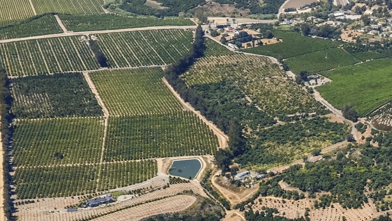
It was still a working ranch, growing lemons and row crops, when the city approved the Pitts Ranch Specific Plan in November 1989. The tract maps were recorded from 1998 to 2002, with one more in 2005, so nearly every home here is about 20 to 28 years old. That makes it one of the newer large neighborhoods in the city.
Most of the homes are houses on their own lots. There are also two attached condominium communities at the south end, an apartment community on Flynn Road, and two groups of houses on private streets: about 220 in the north corner and about 70 west of Flynn Road.
Pitts Ranch Park, about 10 acres, and La Mariposa Elementary School are inside the neighborhood. Water and sewer come from the city, and the 2026-27 tax rate is the same as most of Camarillo, about 1.096%.
I have closed 31 homes in Camarillo, where my office is. Send me the address and I will check it before you write an offer: the tax bill, the zoning, the flood and fire zone maps, and whether the recorded map shows an association.
Questions
Pitts Ranch home buying and selling questions.
Where is Pitts Ranch in Camarillo?
Pitts Ranch is inside the Camarillo city limits, on the northeast side of town. The city's General Plan map of residential neighborhoods shows it as a rough triangle between Lewis Road, which is State Route 34, and Calleguas Creek, with Upland Road at the north tip and the Flynn Road business parks along the south side.
Flynn Road runs through the middle of it, and Mission Oaks is the neighborhood on the other side of the creek. The railroad runs beside Lewis Road along the northwest edge. The city's 1989 plan said that edge would hear passing freight and passenger trains, even with sound walls.
Why is it called Pitts Ranch?
It was a ranch. The city's 1989 plan describes 211 acres, 158 of them Pitts Ranch property, as land traditionally devoted to farming, still in agricultural use at the time, and in the city's agricultural preserve program since 1975. The crops were lemons, with more than 9,000 trees, and row crops such as lettuce, carrots, onions and celery.
By the late 1980s the land around it had been built up, and the plan called the ranch an agricultural island. The city approved the Pitts Ranch Specific Plan on November 1, 1989, and lists its last comprehensive update as August 1997.
When were the homes in Pitts Ranch built, and who developed it?
The county recorded the tract maps from June 1998 through 2002, and one last condominium map in December 2005. The park district dates Pitts Ranch Park to 2003. Census estimates for the two block groups that cover the neighborhood put the median year built at 2003 and 2005.
Pardee Construction Company, whose name is also on Mission Oaks tract maps across the creek, is the owner named on 16 of the 21 recorded tract maps, from 1999 to 2002. The Olson Company's entities are the owners on the two condominium maps at the south end. The maps name the landowner who subdivided, not the builder of each house.
With a home that is 20 to 28 years old, ask your inspector about the age of the roof, the water heater and the heating and cooling equipment.
What kinds of homes are in Pitts Ranch?
The city's parcel map shows about 1,000 separately owned homes. About 850 are houses, and about 150 are attached condominiums in two communities at the south end: one of 120 homes on Via Presidio, Via del Sol and Via Bonito, and one of 30 homes on Cedarbrook Walk and the walks beside it.
About 220 of the houses, in the north corner along Via Arandana, Paseo Girasol and the courts off them, are on private streets. So are the 68 houses west of Flynn Road around Marrisa Way, Valerio Way and Rosetta Way. The recorded maps for the rest of the houses dedicate their streets to the city.
There is also an apartment community of about 250 units on Flynn Road, which the city's map layer names Avalon Camarillo.
Is there an HOA in Pitts Ranch?
In much of it, yes. State law requires a common interest development, which includes a condominium project, to be managed by an association, and the two attached communities at the south end were recorded as condominium maps.
Two groups of houses sit on private streets. In the north corner, about 220 houses, all five recorded maps show private streets, and three of them give the private streets or the landscaped common areas to a homeowners association. West of Flynn Road, the map for the 68 houses around Marrisa, Valerio and Rosetta ways grants its private streets and landscape strips to a homeowners association.
On the public streets, the map for La Puma Court, Las Estrellas Court and Via Secoya sets a landscape parcel aside for a homeowners association. I could not confirm from public records which of the other tracts have one.
The title report and the seller's disclosures show whether a home has an association and what it charges. Read them, along with the association's rules and budget, before you remove your contingencies.
Which schools serve Pitts Ranch?
Pitts Ranch is in the Pleasant Valley School District for transitional kindergarten through 8th grade and the Oxnard Union High School District for 9th through 12th.
La Mariposa Elementary School (TK to 5) is inside the neighborhood. The district's 2025-26 street list assigns every Pitts Ranch street I looked up to La Mariposa and to Las Colinas Middle School (6 to 8), which is on Fieldcrest Drive in Mission Oaks, about two miles away by road.
For high school, Oxnard Union has two campuses close by: Adolfo Camarillo, on Mission Oaks Boulevard, and Rancho Campana, on Mar Vista Drive. Check the address with each district before you write an offer.
What is in Pitts Ranch Park?
It is a community park of about 10 acres at 1400 Flynn Road, open from dawn to dusk. It has play structures for younger and older children, a gazebo, picnic shelters, a softball field, a basketball court, restrooms and a paved walking path.
The park has two courts shared by tennis and pickleball. They are first come, first served, and they are not lighted.
The park's path connects to the bike trail along Calleguas Creek, which runs south to Mission Oaks Boulevard. The Pleasant Valley Recreation and Park District runs the park, and the city counts it as one of its six community parks.
What is the property tax rate in Pitts Ranch?
For 2026-27, all four tax rate areas that cover Pitts Ranch are at 1.0959% of assessed value: the 1% base plus voter-approved school, college and water bonds. That is the same rate as most of Camarillo.
At that rate, a home assessed at one million dollars owes about $10,959 for 2026-27. Tax bills also carry fixed charges, such as the Pleasant Valley Recreation and Park District assessment, which averaged about $54 a parcel in 2025-26.
Your assessed value normally starts at your purchase price and can rise no more than 2% a year until the home sells again or you add new construction.
Is there Mello-Roos in Pitts Ranch?
I found none. The City of Camarillo has one Mello-Roos district, and it covers Spanish Hills and the Ponderosa Drive corridor on the west side of town. None of the parcels in that district's 2025-26 report is in Pitts Ranch.
It is still worth confirming on any home. Enter the parcel number from the tax bill into the city's lookup, and check the title report for any financing lien on the home itself, such as an energy-upgrade loan.
Who provides water and utilities in Pitts Ranch?
The City of Camarillo provides the water, and the Camarillo Sanitary District handles the sewer. On the city's district maps, every Pitts Ranch lot I checked falls inside both. That is different from Mission Oaks, across the creek, where the Camrosa Water District provides both.
Electricity comes from Southern California Edison or Clean Power Alliance, gas from Southern California Gas, and trash and recycling pickup from E.J. Harrison and Sons under a city contract.
Is Pitts Ranch in a flood zone?
No home lot I checked is in a FEMA special flood hazard area. About 30% of the lots are in the 0.2% annual chance zone, often called the 500-year floodplain, and the rest are mapped as minimal flood hazard. The special flood hazard area here is the Calleguas Creek channel itself, along the east edge.
The creek was part of the plan from the start. The 1989 plan noted a bluff of about 20 feet down to the creek, called for channel improvements as the land was built, and set a buffer along the creek.
Flood insurance is required for a home in a high-risk flood area when the mortgage comes from a government-backed lender. Outside those areas it is optional. Your lender's flood determination will tell you where a specific property stands.
Is Pitts Ranch in a wildfire zone?
Almost none of it. On the fire hazard maps that took effect July 1, 2025, about 94% of the lots are outside any mapped zone. The zoned lots are all at the north tip: about 45 touch a Moderate zone, and about 18 lots, nearly all on Del Rayo Court, are at least partly in a High zone. The fire department applies the highest zone on a lot to the whole lot.
The Mountain Fire of November 2024 burned 19,904 acres and destroyed 243 structures. Its mapped perimeter did not reach Pitts Ranch. The nearest edge was about 1.5 miles to the northwest.
A seller of a home in a High or Very High zone must give the buyer documentation that the property meets defensible space rules, under a county fire ordinance in effect since January 1, 2026. Here that touches about 18 lots at the north tip. Look up any address in the county's map viewer to be sure.
Is Pitts Ranch in an earthquake fault zone?
No home lot I checked is in a state Earthquake Fault Zone. The state geologist released the zone maps for this part of Camarillo in 1998. One zone runs through the business parks about 0.2 mile south of the Via Presidio condominiums, on the Pitts Ranch side of the creek.
The city's 1989 plan noted two traces of the Simi-Santa Rosa Fault Zone projected across the ranch, which the state then considered potentially active, and it called for grading and building measures to match.
The city's 2025 Safety Element says Camarillo also has fault-rupture zones of its own that require fault investigations. I found no map of them, so I cannot say whether one touches Pitts Ranch. The Natural Hazard Disclosure report you receive from the seller in escrow shows what applies to a given lot.
How do you get around from Pitts Ranch?
Lewis Road, which is State Route 34, runs along the northwest edge to the 101 freeway. Flynn Road runs through the neighborhood from Upland Road south to Adolfo Road and on to the freeway. Upland Road leads east to Santa Rosa Road.
From Pitts Ranch Park it is about 2 miles by road to the Camarillo train station, about a mile to the Camarillo Library, about 3 miles to City Hall and about 12 miles to the Thousand Oaks Civic Arts Plaza.
The station is on Metrolink's Ventura County Line, which runs to Los Angeles Union Station on weekdays, and Amtrak's Pacific Surfliner stops there too.
How long does it take to sell a home in Pitts Ranch?
It depends on price and condition more than on the neighborhood. Across Ventura County, my own 49 listings since 2022 sold in a median of 11 days on the market, at a median of 100% of the asking price.
Before you list, I walk the home, show you what has actually sold nearby, and tell you what is worth fixing and what is not. Where there is an association, order its documents early so they are ready for the buyer.
Who is a real estate agent for Pitts Ranch?
I'm Jason Walters, and my office is in Camarillo, on Village Commons Boulevard. I have 22 years in real estate, the last 17 in Ventura County.
I have closed 31 homes in Camarillo: 10 for sellers and 21 for buyers. You work with me directly, from pricing strategy to closing day.
Sources for this page (43)
City of Camarillo General Plan, Community Design Element, residential neighborhoods map; City of Camarillo, Pitts Ranch Specific Plan, approved November 1, 1989; City of Camarillo, public map layers (parcels, water and sewer districts, fire zones, apartments); County of Ventura, recorded map of Tract 4682-1 (1998); County of Ventura, recorded map of Tract 4758-1 (1998); County of Ventura, recorded map of Tract 5189 (2002); County of Ventura, recorded map of Tract 5455 (2005); Pleasant Valley Recreation and Park District, Pitts Ranch Park; Pleasant Valley School District, schools and boundaries; Ventura County Auditor-Controller, tax rates 2026-27; City of Camarillo, 2023 General Plan annual progress report; County of Ventura, recorded map of Tract 5077-1 (1999); County of Ventura, recorded map of Tract 5077-5; County of Ventura, recorded map of Tract 5328 (2002); U.S. Census Bureau, American Community Survey 2020-2024, median year built, Census Tract 53.07 block groups 1 and 2; County of Ventura, recorded map of Tract 4758-4; California Civil Code section 4800; California Civil Code section 4100; County of Ventura, recorded map of Tract 4758-2; County of Ventura, recorded map of Tract 4759-1; Pleasant Valley School District, find your neighborhood school (2025-26 tract code book); Oxnard Union High School District, our schools; OpenStreetMap, road distances by route; Pleasant Valley Recreation and Park District, Pitts Ranch pickleball and tennis courts; Ventura County Auditor-Controller, direct assessments 2025-26; Ventura County Treasurer-Tax Collector, how property tax works; City of Camarillo, Mello-Roos special tax information and parcel lookup; City of Camarillo, CFD No. 1 special tax report 2025-26; City of Camarillo, utility contacts; FEMA, National Flood Hazard Layer; FEMA, flood insurance; Ventura County Fire Department, fire hazard severity zone maps; CAL FIRE, Mountain Fire incident; CAL FIRE, California fire perimeters; Ventura County Fire Department, real estate inspection (AB-38); California Geological Survey, earthquake fault zone map layer; California Geological Survey, Alquist-Priolo earthquake fault zones; City of Camarillo General Plan, Safety Element, September 2025; City of Camarillo General Plan, Circulation Element; Metrolink, Camarillo station; Ventura County Transportation Commission, trains; Jason Walters' closing records; About Jason Walters.
Reviewed by Jason Walters, REALTOR®, October 2026.
Ask me
Ask me about Pitts Ranch.
A price, a neighborhood, a home you saw online. You work with me directly, from pricing strategy to closing day.
Nearby
For what it's like to live in Pitts Ranch, see Ventura County Local.
Home value
Thinking about selling in Pitts Ranch?
I'll send you a price range based on what's actually selling nearby.