
Camarillo · Ventura County
Buying or selling in Mission Oaks
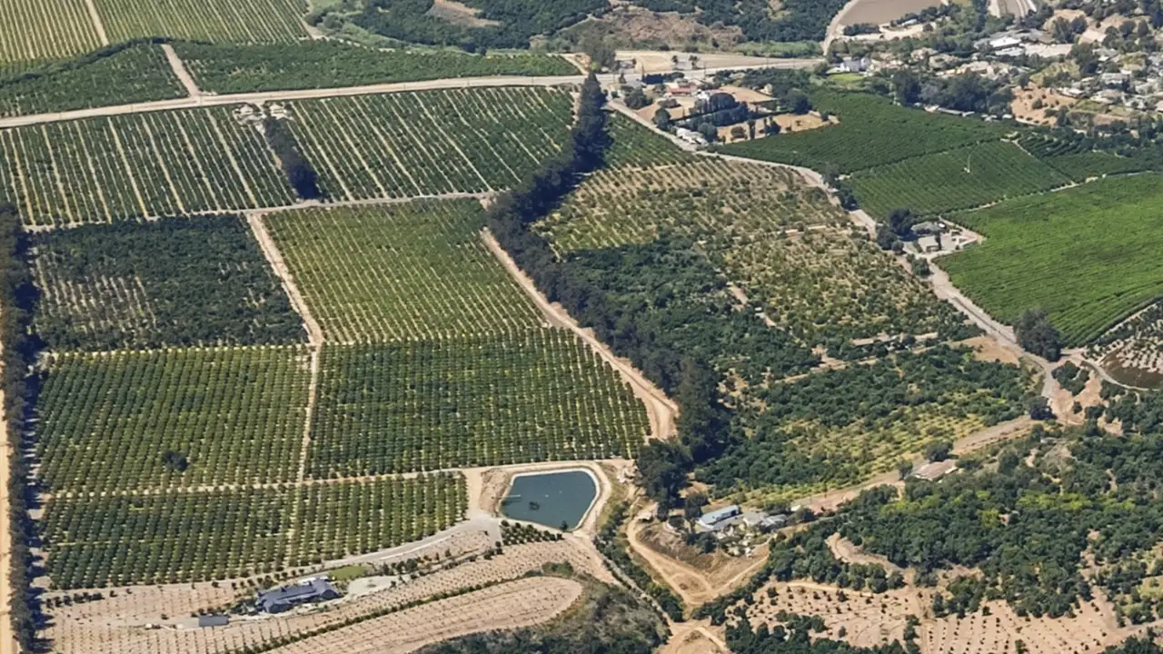
Mission Oaks is a neighborhood in east Camarillo, north of the 101.

Jason Walters
(805) 623-4420 · call or textTrack record
My track record.
- 100%median sale price vs. list price.
- 63%sold at or above asking.
- 11 daysmedian time on market.
- 350+homes sold in my career.
Based on 49 of my closed listings with sale data, January 2022 to September 2026. Source: closing records.
Recent sales at or above asking
100%
of asking · 3 days
5040 Via Fresco
Camarillo · Sold 2026
100%
of asking · 7 days
2485 Elderberry Drive #43
Oxnard · Sold 2026
118.3%
of asking · 6 days
1601 S Ventura Road
Oxnard · Sold 2026
102.3%
of asking · 6 days
1522 Carnation Avenue
Ventura · Sold 2026
100.5%
of asking · 14 days
910 Ivywood Drive
Oxnard · Sold 2026
100%
of asking · 63 days
1950 Devonshire Dr
Oxnard · Sold 2025
101.5%
of asking · 7 days
1200 Entrada Dr
Oxnard · Sold 2025
102.1%
of asking · 13 days
2521 Ironstone St
Oxnard · Sold 2025
Buying
Buying a home in Mission Oaks.
Mission Oaks is the east side of Camarillo, north of the 101 freeway. The city's General Plan map shades the heart of it: east of Calleguas Creek, with Upland Road as the north edge and Santa Rosa Road on the southeast, plus a strip south of Santa Rosa Road along Adolfo Road. The name is also commonly used for two parts the map labels separately: the corner by the creek that it calls Rancho Calleguas, where the 55 and older mobile home park is, and the hillside tracts north of Upland Road. This page covers all three, and the answers below say where a fact differs from one part to another.
Pardee Construction Company bought about 1,150 acres next to the city in 1970, and that fall the city approved its master plan and annexed the land. Pardee is the owner named on tract maps along Mission Oaks Boulevard recorded in 1972 and 1976 and on one from the early 1990s. In the census tracts that cover most of the area south of Upland Road, about a quarter of the homes date from the 1970s, about 40% from the 1980s and about a quarter from the 1990s.
In those same census tracts, about two thirds of the homes are detached houses and about a fifth are attached homes such as townhomes. Mission Oaks Park, about 20 acres, Las Colinas Middle School, Tierra Linda Elementary School and county Fire Station 52 are all here. Adolfo Camarillo High School is at the southwest corner, by the freeway. Leisure Village, the guard-gated community for residents 55 and older, is next door on the south side of Santa Rosa Road.
Three things here differ from most of Camarillo. Water and sewer come from the Camrosa Water District, not the city. State Earthquake Fault Zones cross parts of the area. And two parts are largely in mapped fire hazard zones: the hillside north of Upland Road and one tract at the southeast end. The questions below cover each.
I have closed 31 homes in Camarillo, where my office is. Send me the address and I will check it before you write an offer: the tax bill, the zoning, the water provider, and the flood, fire and fault zone maps.
Questions
Mission Oaks home buying and selling questions.
Where is Mission Oaks in Camarillo?
Mission Oaks is inside the Camarillo city limits, on the east side of town north of the 101 freeway. The city's General Plan map of residential neighborhoods shades it between Calleguas Creek on the west, Upland Road on the north and Santa Rosa Road on the southeast, plus a strip south of Santa Rosa Road that follows Adolfo Road toward Conejo Creek.
The same map labels four neighbors separately: Rancho Calleguas, the corner by the creek around Rancho Adolfo Drive and Via Marquesa; Upland Road, the hillside tracts north of that road; Leisure Village, to the southeast; and Pitts Ranch, across the creek to the west. The map has no legend and its edges are not exact. It also leaves two small groups of streets beside Leisure Village, around Calle Bodega and around Mira Flores Court, out of the Mission Oaks shading.
The name is commonly used more widely than the map draws it. The city's own utility list uses Mission Oaks for the area the Camrosa Water District serves, which takes in the Rancho Calleguas corner and the hillside north of Upland Road, and the county fire department calls its station on Santa Rosa Road the Mission Oaks Fire Station. So this page covers those parts too, and says where an answer differs by place.
The business parks along Mission Oaks Boulevard are west of the creek, toward Flynn Road. The parks and schools here carry the 93012 zip code.
When was Mission Oaks built, and who built it?
Pardee Construction Company bought about 1,150 acres next to Camarillo in the spring of 1970. That fall the city approved Pardee's master plan, annexed the land and zoned it to match. By the spring of 1973, the California Supreme Court later wrote, the city had approved maps for two Pardee tracts, numbers 2189 and 2228, and construction had begun.
Tract 2189 is the Cherry Ridge and Holly Ridge streets, beside Mission Oaks Boulevard. Its map was recorded in October 1972 with Pardee as the owner. Pardee is also named as an owner on a Mission Oaks Boulevard map recorded in 1976 and on one from the early 1990s. Not everything was Pardee's: the tract around Otono and Mira Flores courts, south of Santa Rosa Road, was recorded in 1969 by a different owner, before that land was in the city.
In the census tracts that cover most of the area south of Upland Road, the Census Bureau estimates that about a quarter of the homes were built in the 1970s, about 40% in the 1980s, about a quarter in the 1990s and about 10% since 2000. The park district's dates follow the same path: Encanto Park in 1971, Mission Oaks Park in 1983 and Woodcreek Park in 1994.
With a home from the 1970s or 1980s, the inspection matters. Roofs, plumbing and electrical panels may be original, and it is better to know that before you remove your contingencies.
What kinds of homes are in Mission Oaks?
Mostly detached houses. In the census tracts that cover most of the area south of Upland Road, the Census Bureau estimates that about two thirds of the homes are detached houses, about a fifth are attached homes such as townhomes, about 5% are mobile homes and the rest are in buildings with two or more units.
The city's parcel map shows roughly 4,400 residential lots and condominium units south of Upland Road: about 3,600 in the area the city's map shades as Mission Oaks, about 600 in the Rancho Calleguas corner and about 200 on the streets around Calle Bodega and Mira Flores Court. The hillside north of Upland Road has roughly 950 more. Apartment buildings are on top of that.
The mobile homes are in Rancho Adolfo Mobile Home Estates, a 250-space park on Rancho Adolfo Drive. It is next to Mission Oaks, in the corner the city's map calls Rancho Calleguas.
Is Mission Oaks a 55 and older community?
No. It is an ordinary neighborhood. Of the communities the city's housing plan lists as restricted to residents 55 and older, one is in the area this page covers south of Upland Road: Rancho Adolfo Mobile Home Estates, with 250 spaces, next to Mission Oaks in the corner the city's map calls Rancho Calleguas.
The same list includes a 281-unit senior project by Shea Homes in the far northeastern part of the city, under construction when the plan was written. The plan's survey calls a Shea Homes community Calarosa Ranch, and Calarosa Ranch Road is on the hillside north of Upland Road.
Leisure Village is next door, on the south side of Santa Rosa Road, and the city's map labels it separately. It is a guard-gated community for residents 55 and older, with more than 2,100 single-story homes on about 400 acres and its own association.
Is there an HOA in Mission Oaks?
It depends on the tract. I found no single association that covers all of Mission Oaks, and no public list of which tracts have one.
The recorded maps I read here, for three tracts of detached houses, dedicate their streets to the city, so those streets are public. The maps do not say whether the tract has an association.
The title report and the seller's disclosures show whether a home has an association and what it charges. Read them, along with the association's rules and budget, before you remove your contingencies.
Who provides water in Mission Oaks?
The Camrosa Water District, not the City of Camarillo. The city's own utility list puts Mission Oaks under Camrosa, and on the city's district maps every residential lot I checked falls inside Camrosa's water and sewer areas. That holds for the Rancho Calleguas corner and for the hillside north of Upland Road too.
Camrosa says its drinking water is a blend of about half imported water and half local groundwater. It also runs the sewers here: wastewater from Mission Oaks goes to Camrosa's own reclamation plant, which turns it into recycled water for irrigation.
Electricity comes from Southern California Edison or Clean Power Alliance, gas from Southern California Gas, and trash and recycling pickup from E.J. Harrison and Sons under a city contract.
What is the property tax rate in Mission Oaks?
For 2026-27, every tax rate area I found south of Upland Road, including the Rancho Calleguas corner, is at 1.0959% of assessed value: the 1% base plus voter-approved school, college and water bonds. That is the same rate as most of Camarillo.
The hillside north of Upland Road is at the same rate, except for about 30 lots at its north end. Those are in a tax rate area at 1.083%, with a Somis school bond in place of the Pleasant Valley school bonds.
At 1.0959%, a home assessed at one million dollars owes about $10,959 for 2026-27. Tax bills also carry fixed charges, such as the Pleasant Valley Recreation and Park District assessment, which averaged about $54 a parcel in 2025-26.
Your assessed value normally starts at your purchase price and can rise no more than 2% a year until the home sells again or you add new construction.
Is there Mello-Roos in Mission Oaks?
None that I found. The City of Camarillo has one Mello-Roos district, and it covers Spanish Hills and the Ponderosa Drive corridor on the west side of town. None of the parcels in that district's 2025-26 report is in Mission Oaks, the Rancho Calleguas corner or the hillside north of Upland Road.
A title report will show whether a particular home carries its own financing lien, such as an energy-upgrade loan. To check a parcel yourself, enter the number from its tax bill into the city's lookup.
Which schools serve Mission Oaks?
Mission Oaks is in the Pleasant Valley School District for transitional kindergarten through 8th grade and the Oxnard Union High School District for 9th through 12th.
The district's 2025-26 street list assigns addresses here to one of two elementary schools, depending on the street. Tierra Linda (TK to 5), on Woodcreek Road, takes most of the streets south of Upland Road, including the strip along Adolfo Road. La Mariposa (TK to 5), across the creek in Pitts Ranch, takes some streets on the west side such as Colony Drive, the Rancho Calleguas corner, and the hillside streets north of Upland Road that I looked up. The middle school for all of them is Las Colinas (6 to 8), on Fieldcrest Drive.
Adolfo Camarillo High School is on Mission Oaks Boulevard. About 30 lots at the north end of the hillside carry a Somis school bond on the tax bill instead of Pleasant Valley's. Assignments can change from year to year, so check the address with each district before you write an offer.
What parks are in Mission Oaks?
Mission Oaks Park, at 5501 Mission Oaks Boulevard, is the big one: about 20 acres with three lighted softball fields, six lighted tennis courts, picnic shelters, a snack bar and an off-leash dog area along Fieldcrest Drive. It opened in 1983 and sits next to Las Colinas Middle School.
The smaller parks include Heritage Park (9 acres), Woodcreek Park (5 acres, beside Tierra Linda Elementary and open to the public on weekends and after 3:30 on school days) and two pocket parks, Birchview and Trailside. Calleguas Creek Park is in the Rancho Calleguas corner, Encanto Park is beside the Mira Flores courts, and Quito Park is on the hillside north of Upland Road.
All of them are run by the Pleasant Valley Recreation and Park District. A bike path follows the east side of Calleguas Creek from Adolfo Road to Mission Oaks Boulevard and continues under the 101.
Is Mission Oaks in a wildfire zone?
It depends on the part. On the fire hazard maps that took effect July 1, 2025, about 91% of the residential lots south of Upland Road are outside any mapped zone, about 4% are in a Moderate zone and about 5% are in a High or Very High zone.
Those High and Very High lots are in three places. The largest group is the tract off Adolfo Road at the southeast end, on Camino Deville, Calle Sencillo, Camino El Rincon, Calle Tamega and Camino Leon, where most of the lots are zoned. The other two are the streets around Calle Bodega, south of Santa Rosa Road, and Cervato Drive at the north edge.
The hillside north of Upland Road is different: roughly two lots in three there are in a High or Very High zone. So is more than half of Leisure Village, next door.
The Mountain Fire of November 2024 burned 19,904 acres and destroyed 243 structures. CAL FIRE reported that it was driven into the Camarillo Heights and Camarillo Estates areas. Its mapped perimeter did not reach this side of town: the nearest edge was about two miles northwest of Mission Oaks and a little under two miles from the hillside tracts. Look up any address in the county's map viewer, and get a homeowners insurance quote during your contingency period, before you are committed to the purchase.
What does a seller in a fire zone in Mission Oaks have to provide?
Since January 1, 2026, a county fire ordinance requires the seller of a home in a High or Very High fire hazard zone to give the buyer documentation that the property meets defensible space rules. Where a parcel has more than one zone, the fire department applies the highest one to the whole parcel. Counted that way, the rule reaches roughly 240 lots south of Upland Road and about two thirds of the lots on the hillside north of it.
The fire department does the inspection at no charge. It typically takes 7 to 10 days from the request, and the department recommends at least two weeks before escrow closes. Anything it flags must be corrected within 30 days or before closing, whichever comes first, unless the buyer agrees in writing to finish the work within 60 days after closing.
State law also requires a home-hardening disclosure for homes built before 2010 in these zones.
Is Mission Oaks in a flood zone?
Most of it is not in a high-risk zone. The one group of homes in a FEMA special flood hazard area is on Mira Flores, Madreselva, Otono and Blanco courts, south of Santa Rosa Road beside Leisure Village: roughly 55 lots in a shallow-flooding zone, with about 15 more touched by its edge. About a dozen lots elsewhere touch a mapped flood zone at the edge of Calleguas Creek or Conejo Creek.
A wider area is in the 0.2% annual chance zone, often called the 500-year floodplain, which is not a special flood hazard area. It takes in nearly all of the Rancho Calleguas corner and, counting that corner, more than a quarter of the lots south of Upland Road. The hillside north of Upland Road is mapped as minimal flood hazard.
Calleguas Creek runs along the west edge in its own mapped channel. The larger flood zone on this side of town is next door, along Conejo Creek, where more than half of Leisure Village is mapped in a special flood hazard area.
Flood insurance is required for a home in a high-risk flood area when the mortgage comes from a government-backed lender. Your lender's flood determination will tell you where a specific property stands.
Is Mission Oaks in an earthquake fault zone?
Parts of it are. The state geologist released Earthquake Fault Zone maps for this part of Camarillo in 1998 and 1999, along strands of what the state's map calls the Simi-Santa Rosa Fault Zone. By my count from the state's map layer, roughly one residential lot in seven south of Upland Road is inside a zone, and so is more than a third of the lots on the hillside north of it.
The zones run in bands: near Adolfo Road on the west side, where they take in about a third of the Rancho Calleguas corner; along Santa Rosa Road in the southeast, including the streets around Calle Bodega; and along Upland Road and the hillside above it.
A zone is a regulatory strip that surrounds the mapped surface traces of active faults. The law deals only with the ground breaking along a fault, not with shaking. A new structure for people cannot be placed over an active fault, and before a city can permit a new project in a zone it must require a geologic investigation showing that the buildings will not sit on one. The city's 2025 Safety Element says Camarillo also has fault-rupture zones of its own that require fault investigations. I found no map of those.
The seller must disclose a state zone. The Natural Hazard Disclosure report you receive in escrow says whether the home is in an Earthquake Fault Zone, so read that page before you remove your contingencies.
How do you get around from Mission Oaks?
Santa Rosa Road is the main route. It runs from the 101 freeway along the southeast side of the neighborhood to the east city limit, and the city's evacuation study names it as a primary route from this side of town to the freeway. Mission Oaks Boulevard crosses the neighborhood on its way from Upland Road to Dawson Drive, and Upland Road leads west to Lewis Road.
From Mission Oaks Park it is about 3.5 miles by road to the Camarillo train station, about 5 miles to City Hall and about 12 miles to the Thousand Oaks Civic Arts Plaza. The station is on Metrolink's Ventura County Line, which runs to Los Angeles Union Station on weekdays, and Amtrak's Pacific Surfliner stops there too.
The city bus runs a weekday route between Leisure Village and the Community Center, with stops at Mission Oaks Plaza and Santa Rosa Plaza. The city also runs Dial-A-Ride.
How long does it take to sell a home in Mission Oaks?
It depends on price and condition more than on the neighborhood. Across Ventura County, my own 49 listings since 2022 sold in a median of 11 days on the market, at a median of 100% of the asking price.
Before you list, I walk the home, show you what has actually sold nearby, and tell you what is worth fixing and what is not. If the home is in a fire zone or a fault zone, have those disclosures ready on day one.
Who is a real estate agent for Mission Oaks?
I'm Jason Walters, and my office is in Camarillo, on Village Commons Boulevard. I have 22 years in real estate, the last 17 in Ventura County.
I have closed 31 homes in Camarillo: 10 for sellers and 21 for buyers. You work with me directly, from pricing strategy to closing day.
Sources for this page (52)
City of Camarillo General Plan, Community Design Element, residential neighborhoods map; California Supreme Court, Pardee Construction Co. v. City of Camarillo (1984); County of Ventura, recorded map of Tract 2189 (1972); County of Ventura, recorded map of Tract 2381-1 (1976); County of Ventura, recorded map of Tract 4664 (early 1990s); U.S. Census Bureau, American Community Survey 2020-2024, year built (Census Tracts 53.06 and 53.08 and Block Group 3 of Tract 53.07; link opens 53.06); U.S. Census Bureau, American Community Survey 2020-2024, units in structure (Census Tracts 53.06 and 53.08 and Block Group 3 of Tract 53.07; link opens 53.06); Pleasant Valley Recreation and Park District, Mission Oaks Park; Pleasant Valley School District, schools and boundaries; Oxnard Union High School District, our schools; Ventura County Fire Department, Station 52; Leisure Village Association; Leisure Village Association, security; City of Camarillo, utility contacts; Camrosa Water District, water systems; California Geological Survey, earthquake fault zone map layer; City of Camarillo, public map layers (parcels, water and sewer districts, fire zones); Ventura County Fire Department, fire hazard severity zone maps; County of Ventura, recorded map of Tract 2035-1 (1969); Pleasant Valley Recreation and Park District, Encanto Park; Pleasant Valley Recreation and Park District, Woodcreek Park; City of Camarillo, 2021-2029 Housing Element; Camrosa Water District, about the district; Ventura County Auditor-Controller, tax rates 2026-27; Ventura County Auditor-Controller, direct assessments 2025-26; Ventura County Treasurer-Tax Collector, how property tax works; City of Camarillo, Mello-Roos special tax information and parcel lookup; City of Camarillo, CFD No. 1 special tax report 2025-26; Pleasant Valley School District, find your neighborhood school (2025-26 tract code book); Pleasant Valley Recreation and Park District, parks list; Pleasant Valley Recreation and Park District, Heritage Park; City of Camarillo, 2023 General Plan annual progress report; CAL FIRE, Mountain Fire incident; CAL FIRE, Mountain Fire incident update, November 7, 2024; CAL FIRE, California fire perimeters; Ventura County Fire Department, real estate inspection (AB-38); California Civil Code section 1102.19; California Civil Code section 1102.6f; CAL FIRE, defensible space; FEMA, National Flood Hazard Layer; FEMA, flood insurance; California Geological Survey, Alquist-Priolo earthquake fault zones; California Geological Survey, fault trace map layer; California Public Resources Code section 2621.9; City of Camarillo General Plan, Safety Element, September 2025; City of Camarillo General Plan, Circulation Element; OpenStreetMap, road distances by route; Metrolink, Camarillo station; Ventura County Transportation Commission, trains; Camarillo Area Transit, fixed route brochure; Jason Walters' closing records; About Jason Walters.
Reviewed by Jason Walters, REALTOR®, October 2026.
Ask me
Ask me about Mission Oaks.
A price, a neighborhood, a home you saw online. You work with me directly, from pricing strategy to closing day.
Nearby
For what it's like to live in Mission Oaks, see Ventura County Local.
Home value
Thinking about selling in Mission Oaks?
I'll send you a price range based on what's actually selling nearby.