
Ventura County
Buying or selling in Santa Paula
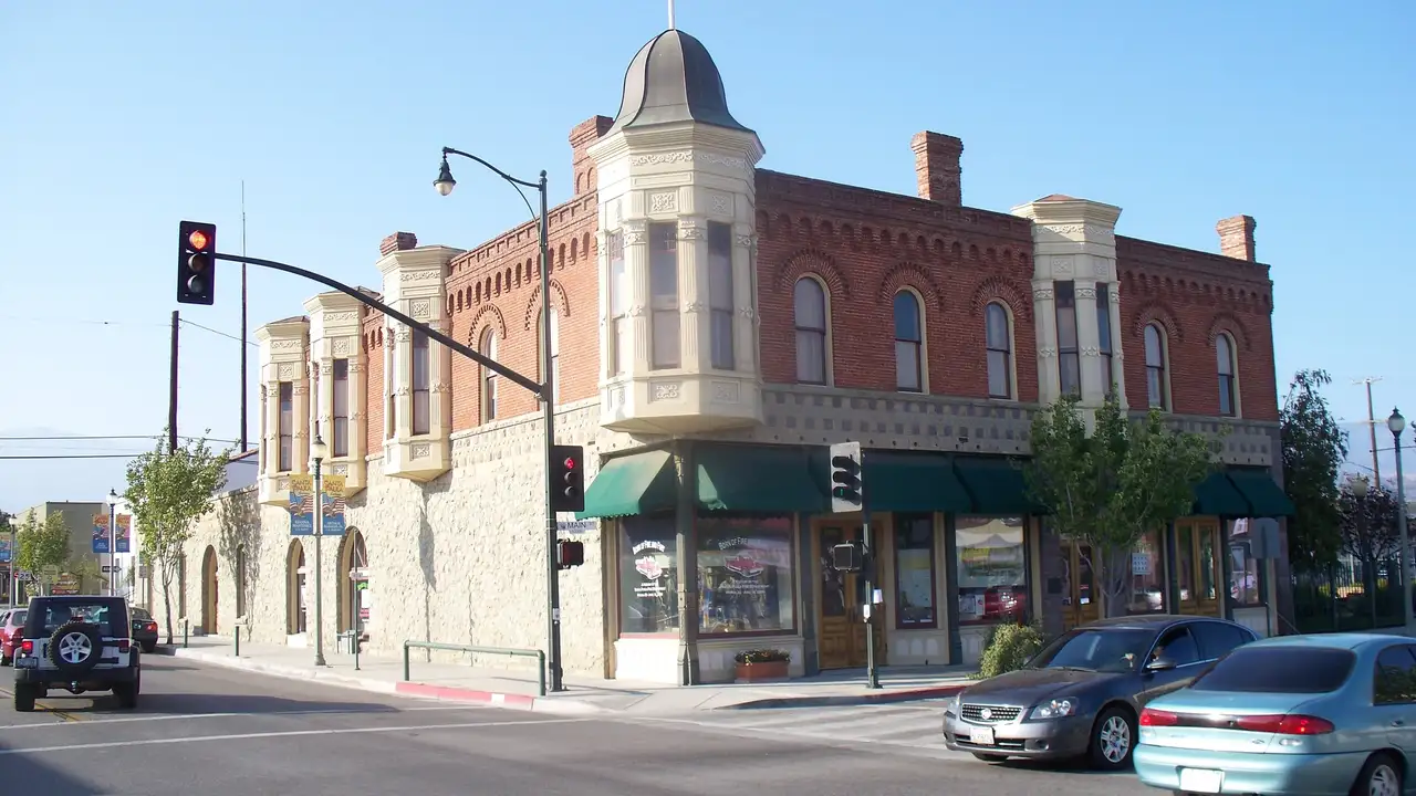
Santa Paula is in the Santa Clara River Valley on Highway 126, east of Ventura.

Jason Walters
(805) 623-4420 · call or textPhoto: Konrad Summers, CC BY-SA 2.0, cropped

Track record
My track record.
- 100%median sale price vs. list price.
- 63%sold at or above asking.
- 11 daysmedian time on market.
- 350+homes sold in my career.
Based on 49 of my closed listings with sale data, January 2022 to September 2026. Source: closing records.
Recent sales at or above asking
100%
of asking · 3 days
5040 Via Fresco
Camarillo · Sold 2026
100%
of asking · 7 days
2485 Elderberry Drive #43
Oxnard · Sold 2026
118.3%
of asking · 6 days
1601 S Ventura Road
Oxnard · Sold 2026
102.3%
of asking · 6 days
1522 Carnation Avenue
Ventura · Sold 2026
100.5%
of asking · 14 days
910 Ivywood Drive
Oxnard · Sold 2026
100%
of asking · 63 days
1950 Devonshire Dr
Oxnard · Sold 2025
101.5%
of asking · 7 days
1200 Entrada Dr
Oxnard · Sold 2025
102.1%
of asking · 13 days
2521 Ironstone St
Oxnard · Sold 2025
Buying
Buying a home in Santa Paula.
Santa Paula is a city of about 31,000 people and about 10,100 homes in the Santa Clara River Valley, on Highway 126 about 16 road miles east of Ventura. About 61% of the homes are detached houses, about 8% are attached single-family homes, about 9% are mobile homes, and about 19% are in buildings of three or more units. A little over half of occupied homes are owned by the people who live in them.
The median home was built in 1970. About 45% of all homes date from the 1960s and 1970s, and about 28% were built before 1960. About 11% were built in 2000 or later, and Harvest at Limoneira on the east side is where new homes are selling as of October 2026.
The Census Bureau's 2020-2024 survey puts the median value of owner-occupied homes here at about three quarters of the county's median, and below its figures for Ventura, Camarillo, Oxnard and Thousand Oaks. That is a survey figure, not a sale price. Tell me the neighborhood and the kind of home you want and I will send you what has actually sold there.
Three things change what a home here costs to own: the flood map, which FEMA redrew in May 2025; the fire hazard zones, which cover the hills on the north side; and the special taxes at Harvest at Limoneira. The questions below sort that out.
My office is in Camarillo and I work across Ventura County. Send me the address and I will check the tax bill, the zoning and the flood zone before you write an offer.
Neighborhoods
Neighborhoods in Santa Paula.
- Harvest at Limoneira
- The master-planned community on the east side, approved for 2,050 homes on about 500 acres. Lennar is selling new detached homes there as of October 2026, and homes there carry Mello-Roos special taxes.
- Downtown and the historic overlay
- The downtown area, which the general plan calls the city's best-preserved section of residential development, with a Historic District overlay north of the business district and landmark houses from the 1880s and 1890s. Changes to a landmark or a home in the overlay need a permit and a public hearing.
- McKevett Heights
- A 1920s tract set above downtown, with curving streets and mostly California bungalows and period revival homes. The general plan names it as a possible historic district.
- The Oaks
- A mid-1920s subdivision of narrow, irregular streets, mature oak trees, river rock walls and generously sized lots, also named in the general plan as a possible historic district.
- North side hillsides
- Streets that climb the hills on the north side, such as Cherry Hill, Monte Vista, Loma Vista and Cliff, are mostly in the Very High fire hazard severity zone. Two small tracts pay their own assessments: the Hillsborough subdivision, for storm drain and flood control upkeep, and Ridgeview at Vista Glen at the north end of Tenth Street, for a geologic hazard district.
- West side
- From about Fourth Street to Steckel Drive south of Main Street, many blocks are in FEMA's high-risk flood zones on the current map. The far west edge is in the Briggs school district and pays a slightly higher tax rate.
- Mobile home parks
- Six parks with about 771 spaces, including Santa Paula West, The 400 Mobile Estates and Rancho Santa Paula. Space rents are limited by a city ordinance.
Questions
Santa Paula home buying and selling questions.
What special taxes do homes at Harvest at Limoneira pay?
Homes at Harvest at Limoneira pay Mello-Roos special taxes on top of the regular property tax. The City of Santa Paula formed Harvest Community Facilities District No. 1 in November 2016, with three improvement areas that follow the phases of the project, to pay for public infrastructure and some city services.
The tax is a fixed dollar amount set by the home's square footage and by which part of the project it is in, and it rises 2% a year. In the first phase (Improvement Area A), 2026-27 county tax bills charge about $2,730 for a home under 1,750 square feet, about $3,140 for 1,750 to 1,950, about $3,520 for 2,151 to 2,350, and about $4,760 for a home of about 3,000 square feet. The second phase, the Foothill neighborhood where Lennar is building, is Improvement Area B. It went on the tax roll for 2026-27 at higher rates: the City's table runs from about $3,500 for the smallest homes to about $7,600 for the largest, and the bills issued so far charge about $6,060 to $7,580 a home. Every Harvest home also pays Harvest CFD No. 2, a flat $297.42 for 2026-27, which the City set up for upkeep of the Santa Paula Creek channel. Ask the builder or seller which improvement area and zone the lot is in.
Lennar, the builder selling there now, lists an approximate total tax rate of 1.82% on its Harvest pages as of October 2026. Treat that as the builder's estimate. The base rate on those streets is about 1.13% for 2026-27, and the special tax is a fixed dollar amount, so the share it adds depends on the home's size and price. Ask for the dollar figure.
In the first phase, the City's bond documents say the main part of the tax can be levied for no more than 40 fiscal years starting in 2019-20, so 2058-59 is the last possible year. In the Foothill phase it runs until the bonds are repaid or 2067-68, whichever comes first. After that, a services tax of about $2,800 a year in 2025-26 dollars, rising 2% a year, continues with no end date. Read the Notice of Special Tax in the seller's or builder's disclosures for the home you are buying. Send me the address and I will check the tax bill before you write an offer.
How big is Harvest at Limoneira, and are new homes selling there?
Harvest at Limoneira is the master-planned community on about 500 acres on the east side of Santa Paula. It is a joint venture of Limoneira Company and the Lewis Group of Companies. The land was annexed to the city in 2013 and grading began in November 2017.
In April 2024 the City Council raised the approved total from 1,500 homes to 2,050, including 300 rental duplexes. A January 2024 presentation to the Planning Commission and City Council counted 586 homes built and sold in the first phase, with 121 more on land first set aside for an elementary school. The second phase, Foothill, is planned for 554 homes and the third for 489. By July 31, 2026 the developer had sold builders lots for 1,261 homes.
As of October 2026, Lennar is selling detached homes in seven collections there. The community has a clubhouse called the Farmhouse with a pool, spa and fitness center, plus Haun Creek Park and McKevett Park. Lennar lists approximate association fees of about $272 to $335, depending on the collection; ask the sales office what period that covers.
You can bring your own agent, but most builders expect that agent to be registered on your first visit, so call me before you tour.
What kinds of homes are in Santa Paula, and how old are they?
About 61% of Santa Paula's homes are detached houses, about 8% are attached single-family homes such as townhomes, about 9% are mobile homes, and about 19% are in buildings of three or more units. About 56% of occupied homes are owned by the people who live in them.
The median home was built in 1970. About 22% of homes date from the 1960s and another 22% from the 1970s. About 28% were built before 1960, and about 9% before 1940. About 11% were built in 2000 or later.
The Census Bureau's 2020-2024 survey puts the median value of owner-occupied homes in Santa Paula at about three quarters of the county's median. That is a survey figure, not a sale price, so ask me for recent sales in the neighborhood you are looking at.
With a home from the 1970s or earlier, the inspection matters. Roofs, plumbing and electrical panels may be original, and it is better to know that before you remove your contingencies.
What is the property tax rate in Santa Paula?
For 2026-27, rates in Santa Paula run from about 1.12% to about 1.15% of assessed value, before fixed charges and special taxes. By my count of the county's parcel map, about nine parcels in ten pay about 1.126%.
What moves the rate is the elementary school district. Most of the city is in Santa Paula Unified. The west edge is in the Briggs district, whose bonds bring the rate to about 1.149%, and a few streets off north Ojai Road are in the Mupu district, at about 1.117%. The high school and college bonds are the same in all three.
On a home assessed at one million dollars, the gap between the top and bottom rates is about $320 a year. Property tax is 1% of assessed value plus voter-approved debt, and assessed value normally starts at the purchase price and can rise no more than 2% a year until the next sale or new construction.
Fixed charges are added on top. For 2025-26 the Blanchard/Santa Paula Library District charged about $40 a parcel. Two small districts cost more: the Hillsborough open space district charged about $150 on each of 71 parcels, and a geologic hazard district at the north end of Tenth Street averaged about $1,250 on 75 parcels.
Is Santa Paula in a flood zone?
Parts of it are, and the maps changed recently. FEMA revised the flood maps along Santa Paula Creek on May 15, 2025, after a larger revision for the Santa Clara River on April 11, 2024. The old zone along the creek, which assumed a flood control project still under construction, was removed, and some areas were mapped as high-risk Zone AE.
By my reading of FEMA's map in October 2026, about one in eight developed parcels in the city is in a high-risk zone, and about 40% more are in the moderate zone FEMA calls the 0.2% annual chance area. About three quarters of the high-risk parcels are on the west-central and southwest side, roughly between Steckel Drive and Fourth Street, most of them south of Main Street. The same band continues east through the blocks south of downtown, around South Seventh and South Eighth Streets and Harvard Boulevard, to Twelfth and Thirteenth Streets near Santa Paula Creek. Built homes at Harvest at Limoneira are outside the high-risk zones, though many are in the moderate one.
The creek channel runs 1.65 miles through the east side. The Army Corps of Engineers built it between 1973 and 2002 for a peak flow of 28,000 cubic feet per second. The county now puts a one percent annual chance flood at about 39,400, says the channel no longer meets its original design intent, and reports that the Corps received money in 2024 to start a new study.
If a building is in a zone that starts with the letter A and the loan comes from a federally regulated or insured lender, flood insurance is required. Send me the address and I will check the flood zone before you write an offer.
Is Santa Paula in a wildfire zone?
Much of the north side is. On the state's 2025 map, about a third of the land inside the city limits is in a Very High fire hazard severity zone, about 14% is High and about 11% is Moderate. Counting developed parcels instead of land, roughly 18% are Very High, 14% High and 11% Moderate.
The Very High zone covers the streets that climb the hills on the north side, including parts of Ojai Road and streets such as Cherry Hill, Monte Vista, Loma Vista, Cliff and Foothill. At Harvest at Limoneira, almost none of the finished first-phase homes are in a zone (about 4%, nearly all Moderate). The newer lots toward the foothills are different: about six in ten are in a zone, and about a third are High or Very High.
The Thomas Fire started on December 4, 2017 near Highways 150 and 126 north of Santa Paula. It burned 281,893 acres in two counties, destroyed 1,063 structures and damaged 274 before it was contained on January 12, 2018. Its mapped perimeter overlaps about 5% of the land inside the city limits.
Get a homeowners insurance quote during your contingency period, before you are committed to the purchase.
What does a seller in Santa Paula have to provide?
The Ventura County Fire Department has served Santa Paula since July 8, 2018, when the city joined the fire district, so the department's sale rule applies here. Since January 1, 2026, the seller of a home in a High or Very High fire hazard severity zone must give the buyer documentation that the property meets defensible space rules. The inspection is free, typically takes 7 to 10 days, and the department recommends at least two weeks before escrow closes.
State law adds a home-hardening disclosure for homes built before 2010 in those zones. The basic standard is 100 feet of defensible space.
I found no city rule requiring a building records report, a pre-sale inspection or a sewer certificate when a home is sold, in a search of the full municipal code. The city's transfer tax is the standard share that state law credits against the county's, so the total is $1.10 per $1,000 of price.
Before you list, I walk the home, show you what has actually sold nearby, and tell you what is worth fixing and what is not.
Which school districts serve Santa Paula?
Most of the city is in the Santa Paula Unified School District. It has six elementary schools for kindergarten through 6th grade (Barbara Webster, Blanchard, Glen City, Grace Thille, McKevett and Thelma Bedell), Isbell Middle School for 7th and 8th grade, Santa Paula High School, and Renaissance High School, a continuation school.
Two small districts cover the edges. Addresses on the west edge are in the Briggs Elementary School District, which runs Olivelands for kindergarten through 4th grade and Briggs for 5th through 8th. A few streets off north Ojai Road are in the Mupu Elementary School District, one school through 8th grade. For high school, both areas are in Santa Paula Unified.
The land first set aside for an elementary school in the first phase of Harvest at Limoneira was replanned for 121 homes in the plan the City approved in 2024, and Harvest streets are in Santa Paula Unified. District lines also change the property tax rate, so check the address with the district before you write an offer.
How do people commute from Santa Paula?
Highway 126 is a freeway through Santa Paula. From City Hall it is about 16 road miles to Ventura, about 10 to Fillmore and about 29 east to Interstate 5 near Castaic. Highway 150 heads north to Ojai, about 17 miles. Downtown Los Angeles is about 64 road miles and Santa Barbara about 44.
There is no passenger train. The Santa Paula Branch Line through town belongs to the Ventura County Transportation Commission, which bought it in 1995 partly to keep the corridor for possible future commuter rail. Today a private railroad operates it for freight and film work, a sister company runs rail bikes, and trains must sound their horns at crossings. The nearest Metrolink station is East Ventura, about 13 road miles away.
The commission's Highway 126 bus line stops in Santa Paula and Fillmore. Santa Paula Airport, about a mile east of downtown, is a privately owned, public-use general aviation airport, home to more than 300 aircraft by its own count.
Can I use a home in Santa Paula as a short-term rental?
No. The City's own answer, as of October 2026, is that it does not currently allow short-term rentals, and that it has no plans to adopt a program because there is not enough demand to justify the cost.
If rental income is part of your plan, count on long-term tenants and not nightly or weekly stays. Read the association's rules too, since an association can be stricter than the city.
What should I know before buying an older home near downtown Santa Paula?
The city has a Historic District overlay on its zoning map, in an area north of the downtown business district, and a list of designated landmarks that includes houses from the 1880s and 1890s. The general plan also calls out McKevett Heights, a 1920s tract of California bungalows and period revival homes, and The Oaks, a mid-1920s subdivision of narrow, irregular streets, mature oaks and river rock walls.
Inside the overlay or on a landmark, changes go through a public hearing. The code requires a permit, heard by the Historic Preservation Commission, to alter, restore, build on, remove or demolish a landmark or a property in the historic district. Owners must also keep the structure in good condition.
So ask the planning division whether the home is in the overlay or on the landmark list, and what past owners had approved. Send me the address and I will check the zoning before you write an offer.
What are the rules for mobile home parks in Santa Paula?
The City counts six mobile home parks with about 771 spaces. The larger ones are Santa Paula West (195 spaces), The 400 Mobile Estates (165), Rancho Santa Paula (149), the Oaks Mobile Home Estates (92) and Anacapa Mobile Home Park (80). About 9% of the city's homes are mobile homes.
In a park you usually own the home and rent the space, and the city limits that space rent. Under the municipal code, the yearly adjustment is 75% of the rise in the consumer price index and no more than 7%, and space rent cannot rise more than 12% in any 12 months. When a home sells in place, the park may charge the new resident a one-time $25 fee, and the City says rent generally does not reset to market.
Parks built after the ordinance took effect and spaces under certain long-term leases are exempt, and the City Council discussed changes to these rules in August 2026. Ask the park for its rules, including any age limit, and the current space rent before you make an offer.
Who provides water, sewer and power in Santa Paula, and what do they cost?
The City runs the water and sewer systems. As of the county boundary commission's 2018 review, the water came entirely from five city wells in the Santa Paula groundwater basin, and sewage goes to a water recycling facility built in 2010.
The schedule on the City's site ends with fiscal year 2023-24. For that year it lists a fixed sewer charge of $83.27 a month for a single-family home, plus $6.25 per account and $1.85 per hundred cubic feet, figured on winter water use. Water is listed at $58.60 a month for a three-quarter-inch meter, or $42.29 for a five-eighths-inch meter, plus $4.12 per hundred cubic feet. The City started a new rate study in 2024, so ask the finance department for today's rates and whether a change is coming.
Clean Power Alliance became the default electricity supplier in March 2024, and Southern California Edison still delivers the power and sends the bill. Athens Services picks up the trash.
One local rule surprises people: since 2006 it has been unlawful to install or replace a salt-based, self-regenerating water softener in a home here. Softeners serviced with portable cartridges that do not discharge brine to the sewer are allowed.
Is there a limit on growth in Santa Paula?
Yes. Voters adopted a City Urban Restriction Boundary in November 2000, and in November 2016 its provisions were extended to December 31, 2050. The measure restricts urban uses of land and urban services outside that line unless voters approve, with narrow exceptions.
A second voter measure, adopted in 2006, sets a public vote for development proposals that would intensify use on 81 acres or more. The measure voters approved in November 2016 also extended that rule to December 31, 2050.
The general plan also describes greenbelts between Santa Paula and Ventura and between Santa Paula and Fillmore. If a home backs up to farmland, expect farm activity next door: the plan cites the county's right-to-farm ordinance, which protects agricultural operations from nuisance lawsuits.
Can I use a VA or FHA loan to buy in Santa Paula?
Yes. For 2026 the conforming loan limit and the FHA loan limit for a single-family home in Ventura County are both $1,035,000. With your full entitlement, VA sets no loan limit: the amount depends on what your lender approves and what the home appraises for.
A mobile home on a rented space is financed differently from a house on its own land, so talk to your lender early if that is what you are buying. I help veterans and active-duty buyers with VA purchases, and my Veterans page explains how.
How long does it take to sell a home in Santa Paula?
It depends on price and condition more than on the city. Across Ventura County, my own 49 listings since 2022 sold in a median of 11 days on the market, at a median of 100% of the asking price.
Before you list, I walk the home, show you what has actually sold nearby, and tell you what is worth fixing and what is not.
Who is a real estate agent for Santa Paula?
I'm Jason Walters, and my office is in Camarillo, on Village Commons Boulevard. I have 22 years in real estate, the last 17 in Ventura County, and I work across Ventura County, including Santa Paula and Fillmore.
You work with me directly, from pricing strategy to closing day.
Sources for this page (66)
U.S. Census Bureau, American Community Survey 2020-2024, Santa Paula population; U.S. Census Bureau, American Community Survey 2020-2024, Santa Paula housing; U.S. Census Bureau, American Community Survey 2020-2024, median year built; U.S. Census Bureau, American Community Survey 2020-2024, median home value, Santa Paula, Ventura County and four cities; OpenStreetMap, road distances by route; City of Santa Paula and FEMA, flood map revision fact sheet, effective May 15, 2025; FEMA, National Flood Hazard Layer; CAL FIRE, fire hazard severity zones in local responsibility areas, 2025; City of Santa Paula, East Area One project; Limoneira Company, annual report (Form 10-K) for the year ended October 31, 2025; Lennar, Harvest at Limoneira; City of Santa Paula, 2040 General Plan, Environmental and Cultural Resources Element; City of Santa Paula, 2040 General Plan, Land Use Element; City of Santa Paula, city and county historic landmark list, June 2020; Santa Paula Municipal Code, chapter 16.33, historic landmark overlay zoning districts; City of Santa Paula, adopted budget 2025-27; Ventura County Auditor-Controller, tax rate book 2026-27, Santa Paula tax rate areas; County of Ventura, Assessor parcel map layer (tax rate area of each parcel); City of Santa Paula, mobile home rent stabilization; Ventura County Treasurer-Tax Collector, secured tax bills for 2025-26 and 2026-27, online lookup; City of Santa Paula, City Council packet of November 1, 2023: Harvest CFD No. 1 Improvement Area A special tax rates and term; City of Santa Paula, City Council packet of January 14, 2026: Harvest CFD No. 1 Improvement Area B rate and method of apportionment; City of Santa Paula, City Council study session packet of August 6, 2025: Harvest CFD No. 2; Ventura County Auditor-Controller, direct assessments 2025-26; City of Santa Paula, staff memorandum on Harvest Community Facilities District No. 1, November 2, 2022; Lennar, Harvest at Limoneira, Grove collection (fees and tax rate); City of Santa Paula, Harvest at Limoneira joint study session, January 29, 2024; Limoneira Company, quarterly report (Form 10-Q) for the quarter ended July 31, 2026; Ventura LAFCo, City of Santa Paula municipal service review, February 21, 2018; Ventura County Auditor-Controller, tax rates 2026-27; U.S. Census Bureau, TIGERweb school district boundaries; Ventura County Treasurer-Tax Collector, how property tax works; Ventura County Public Works, Santa Paula Creek flood risk management project; FEMA, flood insurance; Ventura County Fire Department, fire hazard severity zone maps; CAL FIRE, Thomas Fire incident; CAL FIRE, California historic fire perimeters; City of Santa Paula, fire service; Ventura County Fire Department, Station 29 history; Ventura County Fire Department, real estate inspection (AB-38); California Civil Code section 1102.6f; CAL FIRE, defensible space; Santa Paula Municipal Code, chapter 150, building regulations; Santa Paula Municipal Code, section 37.51, real property transfer tax; Ventura County Clerk-Recorder, fee schedule effective July 1, 2026; California Revenue and Taxation Code section 11911; Santa Paula Unified School District, schools; California Department of Education, California School Directory; City of Santa Paula, 2040 General Plan, Circulation and Mobility Element; Ventura County Transportation Commission, Santa Paula Branch Line; Ventura County Transportation Commission, trains; Ventura County Transportation Commission, Highway 126 bus line; Santa Paula Airport; City of Santa Paula, frequently asked questions; Santa Paula Municipal Code, chapter 152, mobile homes and mobile home parks; City of Santa Paula, water and sewer rate information (through fiscal year 2023-24); City of Santa Paula, Clean Power Alliance; Athens Services, Santa Paula residential service; Santa Paula Municipal Code, chapter 57, water softeners; Ventura County Clerk-Recorder, local measures, November 8, 2016 election; Santa Paula Municipal Code, chapter 16.237, 81 acre initiative implementation; Federal Housing Finance Agency, conforming loan limits 2026; HUD, FHA mortgage limits; U.S. Department of Veterans Affairs, VA home loan limits; Jason Walters' closing records; About Jason Walters.
Reviewed by Jason Walters, REALTOR®, October 2026.
Ask me
Ask me about Santa Paula.
A price, a neighborhood, a home you saw online. You work with me directly, from pricing strategy to closing day.
Home value
Thinking about selling in Santa Paula?
I'll send you a price range based on what's actually selling nearby.